AlphaEarth, Google Deepmind’s newest project, is solving countless researching issues. By joining massive amounts of data together, then using AI to clean up the excess, AlphaEarth has created the biggest collection of data in the world, containing almost if not all data researchers may need. With over eight years worth of research, and more than a trillion embeddings per year, AlphaEarth can solve many issues – including one important controversy.
AlphaEarth, a new project by Google Deepmind, is changing research forever. While in the past researchers have been forced to go to countless sites, searching for the data they need, in many cases going out into the field to redo what should have been accessible research, researchers no longer have to do so. AlphaEarth is a massive compilation of data from everywhere around the world. By using AlphaEarth, researchers can spend less time finding data from many sources, instead devoting their time to establishing facts and inferring new conclusions.
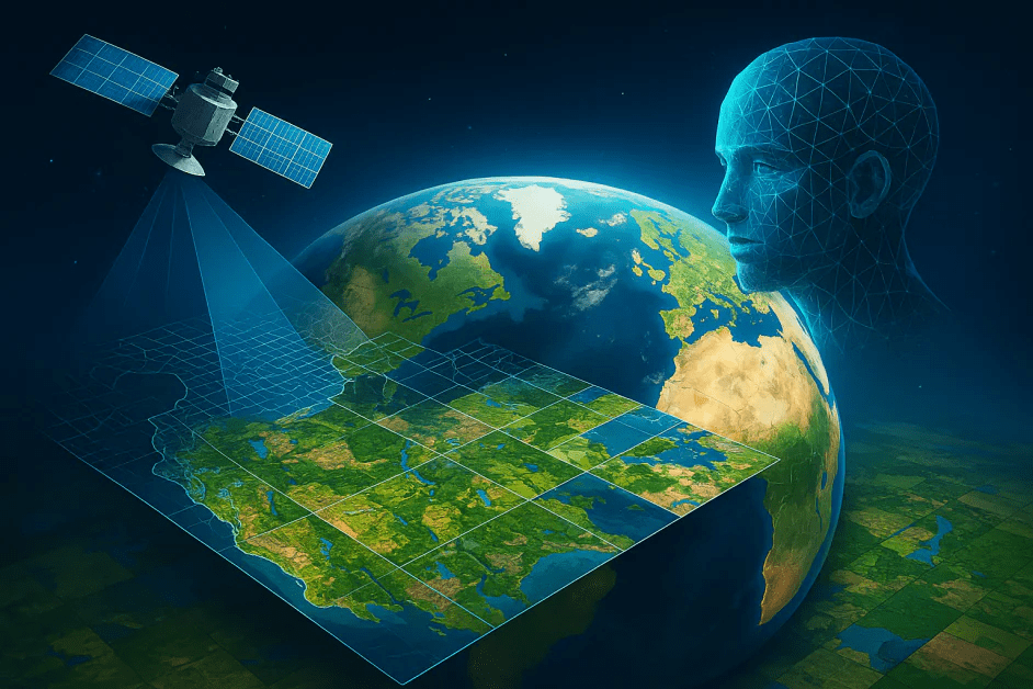
AlphaEarth overlaps satellite data with inferred data to create more complete images.
Taking millions of gigabytes of data from many sources, AlphaEarth’s unique AI molds a highly accurate and detailed model of Earth. By using data from a variety of sources such as radar scans, LiDARs, and climate simulations, AlphaEarth integrates the data, overlapping similar data, to create a highly detailed model. Similar to many of Google Deepmind’s projects, AlphaEarth uses AI to compile the data. The specialized AI creates ten meter squares over the entirety of the globe. Using the data as a reference sheet, it creates a highly detailed 64 dimensional “embedding” of the area. The embedding states information about the habitat, temperatures, and environment of the specific area. AlphaEarth contains over 1.4 trillion highly detailed geospatial embeddings throughout the world for each year of data, which starts from 2017 and goes to 2024, over eight years’ worth of data. After compiling massive amounts of data over the eight years it created, AlphaEarth is able to track the evolution of the planet with startling accuracy. By overlapping so much data, AlphaEarth can fill in many thought-to-be blanks in our research, preventing re-researching a topic many times. Google Deepmind’s AI-powered model is a massive feat unrivaled by any other human or AI created model, and is incredibly useful to researchers all over the globe.
AlphaEarth solves many issues, including data overloading, sparse data solutions, and efficiency in research. Our records of Earth come from innumerable sensors and sites, and even experienced researchers can be overwhelmed by the data. Rather than be forced to take different data information from many areas, researchers need only use a single source, namely AlphaEarth, to collect data from. AlphaEarth contains nearly all data researchers would need, and has organized it impeccably, even more so due to the amount of precision and compactness exhibited. In addition, AlphaEarth is responsible for filling in the blanks of our data. For instance, in areas where there is persistent cloud cover, satellite imagery is unable to take clear mapping photos. AlphaEarth uses data from multiple other sources to fill in the blanks of these areas accurately, providing a continuous, clear model of the earth. Not only does AlphaEarth compile massive quantities of data, and account for machine error, but AlphaEarth is also a highly efficient tool for researchers. Rather than manually process many data layers to reach the information researchers require, AlphaEarth contains all the information on the surface, ready almost instantly for researchers.
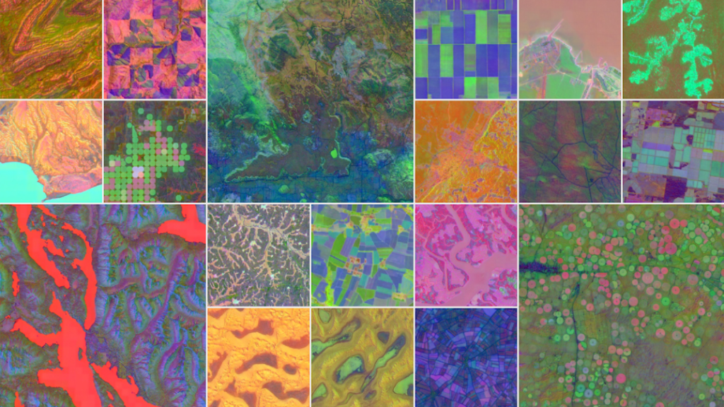
AlphaEarth’s many layers are overlapped to produce highly detailed datamodels.
AlphaEarth provides an accessible solution for businesses, researchers, governments, and activists to monitor and take action on human-caused environmental changes, not only at a national scale, but at an international scale. The public can now receive accurate information on climate change void of media, and worldwide issues such as hunger can be addressed through monitoring of crop health, land changes, and weather prediction. In addition, smaller organizations which are financially unable to complete much data processing can now access ready-to-use data easily, allowing smaller research groups to infer important insights into climate change.
Whether climate change is, in fact, caused primarily by humans has been a highly controversial issue, with some insisting there is too little evidence and others insisting there is an ample amount of evidence. With AlphaEarth, this issue may be solved soon due to the large amounts of evidence showcasing the fact that climate change is caused largely by human activities. With awareness and evidence, the controversy may be solved, and action can begin to be taken in other countries to slow or halt human-caused climate change.
Sources / Useful Links:
Google Deepmind:
AlphaEarth Foundations helps map our planet in unprecedented detail – Google DeepMind
NASA & UN:
ClimateChange | United Nations
Media & Image Credits:
AlphaEarth Foundations helps map our planet in unprecedented detail – Google Deepmind
Discover more from Climate Change
Subscribe to get the latest posts sent to your email.
